Unlocking Mini-Grids for Sustainable Development in Fiji
This presentation outlines a project focusing on electricity exposure assets for sustainable development in Fiji, covering background, data collection, risk analysis, and conclusions. Learn about PCRAFI and the Pacific Catastrophic Risk & Financing Initiative, along with tools used for exposure surveys and data modeling. Explore data collection aids and details of electricity asset attributes collected during the process.

Uploaded on Mar 18, 2025 | 3 Views
Download Presentation

Please find below an Image/Link to download the presentation.
The content on the website is provided AS IS for your information and personal use only. It may not be sold, licensed, or shared on other websites without obtaining consent from the author.If you encounter any issues during the download, it is possible that the publisher has removed the file from their server.
You are allowed to download the files provided on this website for personal or commercial use, subject to the condition that they are used lawfully. All files are the property of their respective owners.
The content on the website is provided AS IS for your information and personal use only. It may not be sold, licensed, or shared on other websites without obtaining consent from the author.
E N D
Presentation Transcript
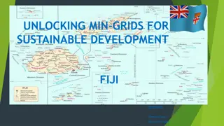
UNLOCKING MINI-GRIDS FOR SUSTAINABLE DEVELOPMENT ELECTRICITY EXPOSURE ASSETS PCRAFI/PARTneR Heilala Conference Room, SPC Narere Campus: Suva, Fiji: 26 30 June 2023
PRESENTATION OUTLINE 1. 2. 3. 4. BRIEF BACKGROUND OF THE PROJECT OVERVIEW OF EXPOSURE SURVEYS, QA/QC & DATA COLLECTION TEMPLATE MODELLING OVERVIEW (RISK ANALYSIS & REPLACEMENT COSTS) CONCLUSION
PCRAFI BRIEF BACKGROUND Pacific Catastrophic Risk & Financing Initiative (PCRAFI) was launched in launched in 2006 Phase I started in 2007 & Phase II in 2016/2019 The Project aims to improve and update PacRIS and contribute towards strengthening the disaster risk finance and insurance capacity of PICs to provide coverage against the potential impacts of natural hazards, through the PCRAFI Program Develop disaster risk assessments tools and practical technical and financial applications to reduce and mitigate the impacts of natural hazards in 14 Pacific Island Countries For further information on PCRAFI II, please visit: https://gem.spc.int/projects/capacity-building-on-the-hazard-and-exposure-database-for-pacific- catastrophe-risk
OVERVIEW OF EXPOSURE SURVEY, DATA PROCESS & RISK/HAZARD MODELLING 1 2 3 Assets Exposure Data Collection Survey Modelling of Exposure data Desktop Review & Data Preparation (Identify & gather existing geospatial datasets & identify gaps) QA/QC Risk Tools/Replacement Cost Conduct Assets Exposure Data Collection Training Uploading datasets into PacRIS
DATA COLLECTION- AIDS/MATERIALS KoBo Toolbox (Humanitarian) QGIS software & QField app Smartphones/ Tablets (or TDG 600 Handheld GPS)
DATA COLLECTION -ELECTRICITY ASSET ATTRIBUTES COLLECTED 4. ASSET MATERIAL 1. GENERAL INFORMATION a. Steel a. Global Positioning System (GPS) Location b. Concrete b. Name/Description c. Steel & Concrete c. Minimum Of 2 Photos d. Other 5. TRANSFORMER TYPE MOUNTING TYPE a. Pad mounted 2. ASSET TYPE b. Pole mounted a. power plant b. transformer 6. OWNERSHIP c. substations a. Private - individual or organization b. Government 3. SOURCE TYPE c. State own enterprise own by business arm of government a. renewable d. Independent Power Producer private entities b. non-renewable 7. CONDITION
DATA COLLECTION TEMPLATE 1. Electricity field data collection template : https://drive.google.com/file/d/1B9lxFJ5JUTN_WK_sXs81aXUtDqaBHyrs/view?usp=sharing 2. Sample of data collected on PacRIS : PACIFIC RISK INFORMATION SYSTEM (SPC.INT) 3. Other data collected: Demography, Infrastructures, Utilities etc..
MODELLING-RISK ANALYSIS Electricity Assets Data Risk Analysis & Replacement Cost modelling
MODELLING-RISK ANALYSIS Risk Analysis Workflow via Riskscape Modelled Exposure Layer PCRAFI 1/2 Nexus/risk.spc.int Replacement Cost (UUC) Modelling Standalone Python Process Tools RiskScape Hazard Analysis Riskscape/QGIS RiskScape software provides a risk analysis framework for calculating natural hazards consequences Nexus/risk.spc.int
CONCLUSION Why hazard risk assessment/assets exposure modelling Planning - Knowing where to set up mini-grids - Hazard areas and risk involved - The presence of infrastructures, utilities, demography, number of houses Estimated Cost Replacement