Explore the agenda, schedules, and updates related to water resource modeling, groundwater monitoring, and the development of new water conservation strategies. Get insights on upcoming meetings, tasks, and discussions within the water planning group.
Please find below an Image/Link to download the presentation.
The content on the website is provided AS IS for your information and personal use only. It may not be sold, licensed, or shared on other websites without obtaining consent from the author. If you encounter any issues during the download, it is possible that the publisher has removed the file from their server.
You are allowed to download the files provided on this website for personal or commercial use, subject to the condition that they are used lawfully. All files are the property of their respective owners.
The content on the website is provided AS IS for your information and personal use only. It may not be sold, licensed, or shared on other websites without obtaining consent from the author.
Upcoming Hood River Schedule April 2nd -Basin Study results. -IFIM results (if complete). -Review of HR Water Conservation Assessment. -Discussion of results/next steps. Water Planning Group meeting May 7th -Basin Study results. -IFIM results (if not done by April 2nd). -Discussion of results/next steps Water Planning Group meeting Transition to new Water Conservation Strategy development (Cindy). June 4th -Basin Study Results. -Discussion of results/next steps for Water Conservation Strategy development (Cindy). Water Planning Group meeting
Transition to new Water Conservation Strategy (Cindy) Purpose: To determine what WPG should do in response to results from Basin Study. Questions / Thoughts: 1). Similar advisory group as WPG? 2). Should we continue to have monthly meetings from July through October; subsequent meeting schedule TBD? 3). Move to OSU Extension. 4). More discussion focused. 5). Cindy is project manager for grant; can facilitate meetings if this is acceptable to the group.
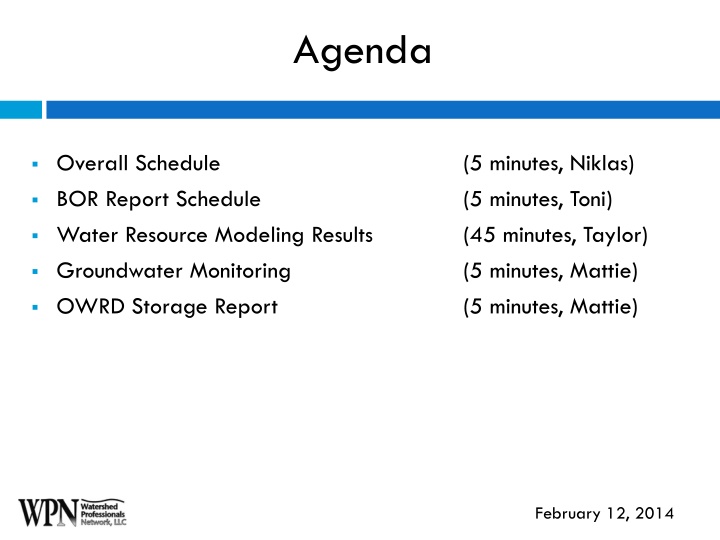
Hello BOR presentations here. Toni then Taylor, I think
Groundwater Monitoring Network Overview of Tasks Mattie s work with administering the HRC Groundwater Monitoring Network has basically been broken into these five tasks: Monitoring Recruitment of New Wells Administration of Data Stakeholder, Public, & Well Owner Outreach Project Documentation & Research 1. 2. 3. 4. 5.
Groundwater Monitoring Network Task #1: Monitoring Completed In January 2014, a total of 57 wells were measured, including18 new wells. Next Steps Next measurements will take place from March 10th through the 14th.
Groundwater Monitoring Network Task #2: Recruitment of New Wells Completed Next Steps From November 2013 to January 2014 an additional 18 wells were added to the network Focus on regions in the County where wells are not being measured. The table below provides a timeline of how many wells have been added to the network from 2009 to the present. Contact well owners in these regions that have been unresponsive to mailings by phone. Number of Wells Date Target wells on properties owned by HRC and USFS. Added January 2009 March 2013 June January 2014 Total 14 18 6 19 57 2013
Groundwater Monitoring Network Task #3: Data Administration Next Steps Continue development of geodatabase combining GPS waypoints with HRC and DOGAMI geodatabases. Completed Collection of Geospatial Data: Geodatabases of all wells in the County developed by HRC and DoGAMI. GPS waypoints taken from wells included in the network. Collection of Non-spatial Data: Well owner information Directions to the well Well Logs Pictures OWRD well measurements QA review and correction of Data for Miss-located Wells Continue collection of well information as wells are included in the network. OWRD will continue to add data to their website as wells are measured on a quarterly basis. Continue QA review of well data.
Groundwater Monitoring Network Task #4: Well Owner, Stakeholder, & Public Outreach Ongoing Yearly informational letters provided to well owners included in the network. Monthly to quarterly updates of progress in administering the network to the WPG and Watershed Group. Development of the HRC website providing information about the monitoring program.
Groundwater Monitoring Network Task #5: Project Documentation & Research Completed Preliminary draft of a report documenting my efforts in expanding the network and alternatives to continue the network. Next Steps Complete draft for review by April 2014.
OWRD Grant Analysis & Reporting Most of the work completed by stakeholders, consultants, and Reclamation fulfill the requirements of the OWRD Grant Agreement (GA). But some remaining work is needed for these three tasks listed in the GA: Task 5: Assess Physical Feasibility of Surface Storage and Other Alternatives: Task 6: Assess Regulatory and Ecological Feasibility of Surface Storage and Other Alternatives: Task 7: Assess Economic Feasibility of Surface Storage and Other Alternatives:
OWRD Grant Analysis & Reporting Evaluation of regulatory, ecological, economic, and physical feasibility of the other alternatives evaluated elsewhere (e.g., Water Conservation Assessment, IFIM Study). Reclamation has done a preliminary assessment of the physical feasibility of surface storage alternatives. From December 2013 to the present, Mattie has been preparing a report which will evaluate the physical, economic, regulatory, and ecological feasibility of the surface water alternatives.
OWRD Grant Analysis & Reporting In the report, Mattie is focusing on the three storage alternatives Reclamation is analyzing in MODSIM: Expansion of Upper Green Point Reservoir Expansion of Laurance Lake A New Reservoir along the West Fork Neal Creek.
OWRD Grant Analysis & Reporting To analyze the physical, economic, ecological, and regulatory feasibility of the alternatives the following metrics are being used: Criterion Physical Feasibility Metric Seismic Hazards Hydrologic Conditions Geology/ Soils Topography Habitat of ESA Listed Species Regulatory and Ecological Feasibility Wetlands Water Available for Appropriation Capital Costs Economic Feasibility Annual Costs
OWRD Grant Analysis & Reporting Draft Report completed by March 2014 Review period during March 2014 Final Report by April 2014 Incorporation of Final Report into OWRD Final Grant Report by May 2014


")