Building Interdisciplinary Partnerships for Academic Impact
Building interdisciplinary partnerships in academia is crucial for driving innovation, tackling complex societal issues, and promoting collaborative research. This involves working across different academic disciplines and with non-academic partners to create meaningful impact. By leveraging diverse expertise and fostering creative solutions, these partnerships can lead to lasting benefits for academia and society as a whole.

Download Presentation

Please find below an Image/Link to download the presentation.
The content on the website is provided AS IS for your information and personal use only. It may not be sold, licensed, or shared on other websites without obtaining consent from the author. If you encounter any issues during the download, it is possible that the publisher has removed the file from their server.
You are allowed to download the files provided on this website for personal or commercial use, subject to the condition that they are used lawfully. All files are the property of their respective owners.
The content on the website is provided AS IS for your information and personal use only. It may not be sold, licensed, or shared on other websites without obtaining consent from the author.
E N D
Presentation Transcript
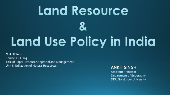
Land Resource & Land Use Policy in India M.A. II Sem. Course: GEO205 Title of Paper: Resource Appraisal and Management Unit II: Utilization of Natural Resources ANKIT SINGH Assistant Professor Department of Geography DDU Gorakhpur University
Land as a Resource Everything available in our environment which can be used to satisfy our needs, provided it economically feasible and culturally acceptable can be termed as a Resource . Land is the most important component of the life support system. It is the most important natural resource which embodies soil and water, and associated flora and fauna involving the ecosystem on which all man s activities are based. Land is an asset of finite magnitude. Land availability is only about 20% of the earth s surface. Growing population, growing needs and demands for economic development, clean water, food and other products from natural resources, as well as degradation environmental impacts are posing increasing pressures to the land resources , therefore, it is important to use the available land for various purposes with careful planning. is technologically accessible, of land and negative
Land Resources of India Total geographical area of India is 3.28 million sq.km. Land use data, however, is available only for 93% of the total geographical area because the land use reporting for most of the north-east states except Assam has not been done fully. Some areas of J&K occupied by Pakistan and China have also not been surveyed. India, with only 2.4% of world s total land area is supporting over 17% and 15% of world s human and livestock population, respectively. India has land under a variety of relief features, namely: mountains, plateaus, plains and islands. About 43% of the land area is plain, which provides facilities for agriculture and industry. Mountains account for 30% of the total surface area of the country and ensure perennial flow of some rivers, provides facilities for tourism and ecological aspects. About 27% of the area of the country is the plateau region. It possesses rich reserves of minerals, fossil fuels and forests.
Land Use Classification in India Forests Land not available for cultivation Area under non-agricultural uses, e.g. buildings, roads etc. Barren and un-culturable land Other uncultivated land (excluding fallow land) Permanent pasture and other grazing land Land under misc. tree crops and grooves (not included in net area sown) Culturable waste land (left uncultivated for more than 5 agricultural years) Fallow lands Other than current fallow (left uncultivated for the past 1 to 5 agricultural years) Current fallows (left without cultivation for 1 or less than 1 agricultural year) Net Sown Area Area sown more than once in an agricultural year plus net sown area is known as gross cropped area.
Land Use Policy in India: Before Independence The land-revenue system implemented by Todar Mal during Akbar's regime can be traced as the possible beginning of systematic efforts to manage the land. This method incorporated measurement, classification and fixation of rent as its main components. Throughout much of the country, the rulers appointed Zamindars, or tax collectors, who were contracted to collect land revenue for a given large territory and pay fixed sums to the government. Though tenurial conditions varied significantly from region to region, the numerous tenures could be classified under two broad categories - the Zamindari and Rayatwari systems. The Zamindari system was characterized by one or more layers of proprietary rights between the state and the actual landholder. In the Rayatwari (or peasant proprietorship) system, no intermediaries existed in design but emerged in the process. The Colonial Government, out of its interest to administer the country effectively, did not make any substantial changes in the land-revenue system but promoted the class of non-cultivating intermediaries.
Land Use Policy in India: After Independence Land policy in India has undergone broadly four phases since Independence The first and longest phase (1950 - 72) consisted of land reforms that included three major efforts: abolition of the intermediaries, tenancy reform, and the redistribution of land using land ceilings. The abolition of intermediaries was relatively successful, but tenancy reform and land ceilings met with less success. The second phase (1972 - 85) shifted attention to bringing uncultivated land under cultivation. The third phase (1985 - 95) increased attention towards water and soil conservation through the Watershed Development (DPAP) and Desert-Area Development Programmes (DADP). A central government Waste land Development Agency was established to focus on wasteland and degraded land. Some of the land policy from this phase continued beyond its final year. The fourth and current phase of policy (1995 onwards) centres on debates about the necessity to continue with land legislation and efforts to improve land revenue administration and, in Development, Drought-Prone Area particular, clarity in land records.
Need for Land Use Policy in India The per capita arable land in the country is only 0.16 ha and it is expected to comedownto 0.08 ha by2025. India envisionsthat infrastructure across thecountry mustexpandrapidly. Industrialisation, especially in the manufacturing sector, is inevitable and will accelerate. Urbanisationis on drasticrise. Agricultural lands are becoming important as livelihood of a significant amount ofthecountry s population is dependenton it. In addition, the Government also requires land from time to time for a variety of publicpurposes. The developmental targets of India on one hand and the social, cultural and environmental aspects on theotherhand demandland. The country can no longer afford to neglect land, the most important natural resource,so asto ensuresustainability and avoidadverseland use conflicts.
Core Issues to be Addressed Unregulatedland use shifts Reducing per capita land resource Meeting the demands of rural and agriculture sectors Protecting lands undernatural resources and ecosystem services Meetingurbanisation demands Meeting industrialisation demands Meeting mining sector demands Meeting transport sector demands Developmentvs. sustainable development Protecting social interests Protecting heritage Inadequateland use planning capacities
National Land Utilization Policy Guiding Principles 1stPrinciple: Humanbeings are at the centre 2nd Principle: Inclusive growth, poverty eradication and gender equality equal opportunities 3rd Principle: Balanced development and intergenerational justice 4th Principle: Efficient utilisation of resources and mitigation of impacts 5thPrinciple: Integrated and comprehensive development planning 6th Principle:TheStatesare custodian of land 7th Principle: Harmonization with existing policy, legislative and regulatory framework
Main Objective of the National Land Utilisation Policy Goal: The goal of the National Land Utilisation Policy is to achieve improvement of livelihood, food and water security, and best possible realization of various developmental targets so as to ensure sustainable developmentof India. Objective: To ensure optimal utilisation of the limited land resources in India for achieving sustainable development, addressing social, economic and environmental considerations and to provide a framework for the States to formulate their respective land utilisation policies incorporating state- specific concerns and priorities.
Objectives of the National Land Utilisation Policy Protection of agricultural lands from land use conversions so as to ensure food security and to meet consumptionneeds ofagrowingpopulationandtomeet livelihoodneeds ofthedependent population. To identify and protect lands that are required to promote and support social development, particularly of tribalcommunities andpoorsectionofsocietyfortheir livelihood Topreservehistoric andcultural heritage byprotecting,places/sites ofreligious,archaeological,scenic and tourist importance To preserve and conserve lands under important environmental functions such as those declared as National Parks, Wild Life Sanctuaries, Reserved Forests, Eco Sensitive Zones, etc. and guide land uses around such preserved and conserved areas so as not to have land use conflicts or negative environmental impacts. Topreserve the areasofnaturalenvironmentandits resources that provideecosystem services. To promote properly guided and coordinated development in a sustainable manner of all developmental sectors including agriculture, urban, industrial, infrastructure and mining so as to minimise land use conflictsor negativeenvironmentalimpacts. To suggest a general implementation framework for implementing land utilisation policy by all concerned atdifferent levels,viz.national,state,regionalandlocal,andundertakingcapacitybuilding.
Overall Approach of the National Land Utilisation Policy The lands in the country will be divided into Land Utilisation Zones (LUZs) based on thepredominant use ofthose lands. The following six types of Land Utilisation Zones (LUZs) are to be identified on thebasis ofpredominant land use: a) Predominantly Rural andAgriculturalAreas; b)AreasUnderTransformation; c)PredominantlyUrbanAreas; d) Predominantly IndustrialAreas; e) Predominantly Ecological Areas, Landscape Conservation & Tourism Areas. HeritageAreas;and f)MajorHazardVulnerableAreas. LUZs will be subjected to land use planning in the form of Regional Development Plans and Development Plans.
Contd The LUZ will most probably not follow administrative boundaries but functional onesand that itis, therefore,always a decisiontobetakenon theboundaries. For all LUZs , land use planning should be undertaken independently or wherever possible, integrated into the Regional Plans, District Development Plans (covering both rural and urban areas), Master Plans of cities or Zonal Development Plans of Eco Sensitive Zones or Development Plans of Industrial InvestmentRegions. For the purpose of better management of land utilisation, the land uses in the Regional Development Plan or Development Plan are categorised into Land- use Management Areas (LMAs) to ensure protection, regulation, control and guided development or even reserve lands in accordance with legal provisions and priorityneedsofvarious sectors. For the purpose of ensuring proper management of lands, the Land-use ManagementZonesare categorisedinto: (a)ProtectedAreas (b)RegulatoryAreas (c)ReservedAreas (d)GuidedDevelopmentAreas.
Implementation of the National Land Utilisation Policy Development ofStateLandUtilisationPolicy Identification of LandUtilisationZones Planning of LandUtilisationZones PerspectivePlan(20-25 years) Land Use Plan: This includes a) Regional Development Plan, and b) Development Plan orMaster Plan. Institutionalset-up NationalLandUseCouncil chairedbyPrimeMinister ofIndia and Ministers of key ministries as its members. National Land Use Committee chaired by Minister for Rural Development and Secretaries ofkeyministries as its members. ProvisionState level andDistrict levelCouncilsandCommittees.
The test of our progress is not whether we add more to the abundance of those who have much; it is whether we provide enough for those who have too little. - Franklin Delano Roosevelt