Developing GIS Pedagogy for Teacher Trainees
This project explores the development of Geographic Information Systems (GIS) understanding among Geography trainee teachers, focusing on their initial perceptions and growth over a PGCE year. The research design involves interpretive case studies with various methods to investigate how best to support trainee teachers in integrating GIS into their practice. The training programme includes hands-on activities and mentor support to enhance their GIS skills and confidence.

Download Presentation

Please find below an Image/Link to download the presentation.
The content on the website is provided AS IS for your information and personal use only. It may not be sold, licensed, or shared on other websites without obtaining consent from the author. If you encounter any issues during the download, it is possible that the publisher has removed the file from their server.
You are allowed to download the files provided on this website for personal or commercial use, subject to the condition that they are used lawfully. All files are the property of their respective owners.
The content on the website is provided AS IS for your information and personal use only. It may not be sold, licensed, or shared on other websites without obtaining consent from the author.
E N D
Presentation Transcript
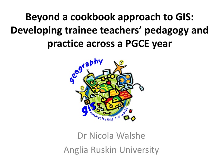
Beyond a cookbook approach to GIS: Developing trainee teachers pedagogy and practice across a PGCE year Dr Nicola Walshe Anglia Ruskin University
Project Rationale 1. The argument for GIS: The educative The workplace The place-based 2. Government policy emphasis on the use of GIS in Geography 3. Minimal engagement with GIS in schools and across ITE 4. A lack of detailed, research-based evidence for how to develop GIS in ITE, particularly in the UK (Bednarz, 2004)
Research Design Interpretive, multiple methods case study underpinned by a constructivist epistemology Research questions: 1. What are trainee teachers understandings of the nature and value of GIS at the beginning of their training? 2. How and by what processes do these develop over the course of the year? 3. How can trainee teachers best be supported in developing their use of GIS, particularly within the context of a PGCE course? Questionnaires , interviews and observations of trainee teaching practice 16 Geography PGCE trainees with a range of experience with GIS
PGCE Training Programme September Introduction to ArcGIS Online Free licenses from Esri November FSC ArcGIS Online and field work December ArcGIS Online training day PLUS mentor training 1 January Compulsory story map activity March Advanced ArcGIS Online training May ESRI Conference, London June Geographers train the biologists June Dissemination event PLUS mentor training 2
Some results a method for mapping spatial data a computer-based software that allows you to collect, store, process, display, analyse geospatial data it's good to show that geography has an IT side to it it gives a bit more of an exciting element to the course it enables you to get data presented and the more boring parts of analysis done very quickly, so you can focus on higher order geographical learning
Some results It was one of those things where you jumped through the hoops, you had problems, you asked the coordinator, and then you ticked the box 'Thank god I've done that' and then you moved on Trainee confidence with using GIS
Vignettes Krissie Previous experience with QGIS Quickly from functionality to TPACK (Mishra and Koehler, 2006) Range of practice supporting student- centred, enquiry-based education Advocate for GIS with and beyond PGCE Jack Dangermond Award [It is] really useful for a whole range of tasks from something where it's just a very quick introductory starter through to a whole sequence of lessons where it s part of a problem-based learning exercise. [GIS] moves forward students understanding of topics in geography and also their skills.
Craig Vignettes Little previous experience Epistemological standpoint: it doesn t see the world in a way that I want to see the world Struggling with practical demands of course I really do wish I had engaged with GIS this year but for whatever reason accumulated exhaustion perhaps I didn t manage to . Before I saw GIS as a quite closed, limited way of viewing the world (a bunch of quantitative stuff or stats) but now I can see there is a lot of creative potential for understanding (as well as teaching) geography..... it s a very neat way of exploring the complexity of places too .
How can trainee teachers best be supported in developing their use of GIS? 1. The importance of disciplinary knowledge 2. The balance between application and transferability It was really useful ... but I still feel like I would struggle to create things which were not almost identical to those done in Faculty
How can trainee teachers best be supported in developing their use of GIS? 1. The importance of knowledge 2. The balance between application and transferability 3. Trainee teachers self-efficacy (Bandura, 1986; Pajares, 1996) when the kids are going 'Oh Miss, can you just give it to me on a piece of paper?' you think 'I'm teaching this wrong because they're being quite resistant , rather than thinking no, this is a different approach to learning, this isn't being spoonfed, they're really having to think for themselves and they will get there, but I have to hold my nerve.
How can trainee teachers best be supported in developing their use of GIS? 1. The importance of knowledge 2. The balance between application and transferability 3. Trainee teachers self-efficacy (Pajares, 1996; Bandura, 1986) 4. The role of schools in the teacher training partnership Year eight were quite resistant to it. There it wasn't encouraged, it wasn't on the radar of the school, so Technology infrastructure it wasn't being pushed from the school's point of view .it was only me, I never ever saw the geography teachers using IT Assessment and accountability Departmental attitude was a scepticism that the software and the hardware was actually going to function they weren't prepared to trust [it].
How can trainee teachers best be supported in developing their use of GIS? 1. The importance of knowledge 2. The balance between application and transferability 3. Trainee teachers self-efficacy (Pajares, 1996; Bandura, 1986) 4. The role of schools in the teacher training partnership Technology infrastructure load and students become a bit restless behind you that's a chaotic start to the lesson straight on the lesson observation Assessment and accountability Departmental attitude if something takes a couple of minutes to
Learning culture in schools? Trainee expertise with new pedagogy Trainee has their own niche Departmental culture Mentor attitudes and confidence Trainee conforms to the culture of the school Trainee disempowerment Particularly if low self-efficacy
References Bandura, A. (1986). Social foundations of thought and action: A social cognitive theory. Englewood Cliffs, NJ: Prentice Hall. Bednarz, S. W. (2004). Geographic information systems: A tool to support geography and environmental education? GeoJournal, 60(2), 191 199. Mishra, P., & Koehler, M.J. (2006). Technological pedagogical content knowledge: A framework for integrating technology in teacher knowledge. Teachers College Record, 108(6), 1017-1054. Pajares, F. (1996). Self-Efficacy Beliefs in Academic Settings. Review of Educational Research, 66(4), 543 578.