Exploring United States History and Geography for 5th Graders
Dive into the introductory lessons of United States history and geography with topics such as U.S. geography, compass rose, map legends, latitude and longitude, and geographical features. Understand the significance of key elements in maps and explore various geographical features of the U.S., including rivers, lakes, mountains, and more.

Download Presentation

Please find below an Image/Link to download the presentation.
The content on the website is provided AS IS for your information and personal use only. It may not be sold, licensed, or shared on other websites without obtaining consent from the author. If you encounter any issues during the download, it is possible that the publisher has removed the file from their server.
You are allowed to download the files provided on this website for personal or commercial use, subject to the condition that they are used lawfully. All files are the property of their respective owners.
The content on the website is provided AS IS for your information and personal use only. It may not be sold, licensed, or shared on other websites without obtaining consent from the author.
E N D
Presentation Transcript
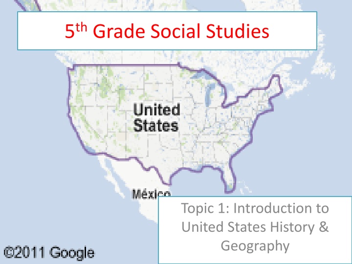
5thGrade Social Studies Topic 1: Introduction to United States History & Geography
Topic 1: Introduction to United States History & Geography LESSON: 1 Intro to U.S. Geography
Vocabulary Compass Rose Map Legend Latitude Longitude Geographical feature
The Compass Rose The compass rose is a design, often with decorations, to show direction. Usually, north is at the top, south is at the bottom, east is on the right, and west is on the left. The directions are commonly abbreviated to their first letters, for example "E" for "east.
Compass Ross The compass rose can be divided further to show more directions: northeast for the area between north and east; northwest for the area between north and west; southeast for the area between south and east; southwest for the area between south and west.
The Legend The legend, or key, can be used to understand the symbols included on the map. Symbols such as lines, colors, or pictures are often used in maps to represent geographical features, such as lakes, rivers, or mountains. They can also be used to represent borders between countries, cities, capitals, and other manmade landmarks. Samples of common map symbols are shown in the legend at right
Latitude/Longitude Longitude The distance of a place east or west Latitude The distance of a place north or south
Geographical Features Geographical features include Mountains Plateaus Deserts Bodies of water
Geographical Features of US Colorado River Missouri River Columbia River Rio Grande Mississippi River Ohio River Hudson River St. Lawrence River Great Salt Lakes Lake Superior Lake Erie Lake Michigan Lake Huron Lake Ontario
Cont. Rocky Mountains Appalachian Mountains Great Plains
Topic 1: Introduction to United States History & Geography LESSON: 3 Regions of the US
Regions of the US New England Region Middle Atlantic Region Appalachian Highlands Southeast Region Midwest Region Great Plains or Heartland Region South Central Region Mountain West Region Pacific West Region
New England Made up of Connecticut, Maine, Massachusetts, New Hampshire, Vermont, and Rhode Island, New England is the easternmost region of the United States. The Atlantic Ocean shoreline in New England is dotted with many islands, bays, and coves. Some of the earliest and most successful English colonies were established here, giving the region its name.
The Mid-Atlantic States The Mid-Atlantic region is comprised of the Appalachians and their foothills and Atlantic Coastal Plain. To the north and northwest, it is bordered by the easternmost Great Lakes. The region includes Delaware, Maryland, New Jersey, Pennsylvania, and New York, which is home to largest city in the United States, New York City.
The Appalachian Highlands Several mountain ranges make up the Appalachians, including: the Blue Ridge Mountains and the Smokies. Kentucky, North Carolina, Tennessee, Virginia, and West Virginia are the region's states, and along the Atlantic Ocean in North Carolina, a thin chain of islands called the Outer Banks protect the mainland from the sea
The Southwest States such as Arizona and New Mexico, in the western portion of the region, have large expanses of desert as well as canyons, mesas Grand Canyon, located in Arizona States such as Oklahoma and Texas, in the eastern portion, are characterized by broad grasslands.
The Midwest The states surrounding the Great Lakes make up the Midwest. Major cities and manufacturing centers like Detroit, Michigan; Chicago, Illinois; and Cleveland, Ohio border the lakes. Farther away from the lakes are agricultural areas, including a major center of dairy farming in Wisconsin and soybean production in Indiana.
Mountain States The Rocky Mountains are the dominant geographic feature of this region of the West. Colorado, Idaho, Montana, Nevada, Utah, and Wyoming are among the most sparsely populated states in the contiguous 48 and have a fairly dry climate. The eastern edge of this region levels off to broad, rolling prairies.
The Heartland The dominant geographic feature of the Heartland is the broad expanse of the Great Plains. The states in the region North Dakota , South Dakota , Nebraska , Kansas , Minnesota , Iowa , and Missouri are considered to be the "breadbasket of America" and produce agricultural staples such as corn, wheat, milk, and cattle for the United States and the world.
The Southeast Many of the most low-lying areas in the United States are in the Southeast. The Mississippi River, which tracks the borders of Arkansas and Mississippi, empties into the Gulf of Mexico in Louisiana. States such as Alabama, South Carolina, and Georgia have piney forests and swamps, and Florida, a peninsula between the Atlantic Ocean and the Gulf of Mexico, has a tropical climate.
Pacific Coast States The states of the contiguous 48 that border the Pacific Ocean include Washington, Oregon, and California. They are characterized by soaring, snow-capped mountains surrounded by fertile valleys and forests, and contain arid desert areas to the east. This region is also geologically active, with earthquake-prone areas and volcanoes.