WIVERN Satellite Mission Overview
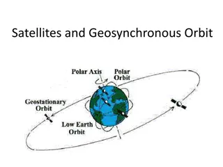
The WIVERN satellite mission, led by Alessandro Battaglia and Anthony Illingworth, aims to provide global in-cloud wind, precipitation, and cloud property data to enhance numerical weather prediction and climate modeling. The radar instrument concept includes a W-band conically scanning Doppler radar with a large antenna for detailed atmospheric measurements. Scientific goals focus on improving predictive skills, climate record benchmarking, and model parameterizations for various applications. Lessons learned from previous missions like Aeolus highlight the crucial role of wind observations in weather forecasting accuracy.

Download Presentation

Please find below an Image/Link to download the presentation.
The content on the website is provided AS IS for your information and personal use only. It may not be sold, licensed, or shared on other websites without obtaining consent from the author.If you encounter any issues during the download, it is possible that the publisher has removed the file from their server.
You are allowed to download the files provided on this website for personal or commercial use, subject to the condition that they are used lawfully. All files are the property of their respective owners.
The content on the website is provided AS IS for your information and personal use only. It may not be sold, licensed, or shared on other websites without obtaining consent from the author.
E N D
Presentation Transcript
WIVERN (WInd Velocity Radar Nephoscope) EE-11 candidate mission Alessandro Battaglia Anthony Illingworth and the WIVERN MAG 1
Earth Explorer 11: roadmap to selection Launch 2030 SciReCS study Science lead @ PoliTo 1. CAIRT 2. NITROSAT 3. SEASTAR 4. WIVERN 2
WIVERN radar instrument concept W-band (94 GHz, like for CloudSat and EarthCARE) conically scanning Doppler (polarization diversity) big antenna ( 3dB 0.08o) Battaglia et al., AMTD 2021 Wolde et al., AMT 2018 Battaglia et al, AMT, 2018 Illingworth et al., BAMS, 2018. Battaglia et al, IEEE TGRS, 2017 Battaglia et al, JTech, 2015 For one revolution of the antenna the cycloid ground track advances 35 km along the satellite track Footprint moves 500 km/s. PRF 4kHz (every 250 sec 37 km) yielding one pulse in the atmosphere at a time One radar sample every 125 m along the footprint track, yielding 8 radar reflectivity estimates every km 3
WIVERN radar instrument concept Hurrican Igor W-band (94 GHz, like for CloudSat and EarthCARE) conically scanning Doppler (polarization diversity) big antenna ( 3dB 0.08o) Battaglia et al., AMTD 2021 Wolde et al., AMT 2018 Battaglia et al, AMT, 2018 Illingworth et al., BAMS, 2018. Battaglia et al, IEEE TGRS, 2017 Battaglia et al, JTech, 2015 For one revolution of the antenna the cycloid ground track advances 35 km along the satellite track Attenuation & Footprint moves 500 km/s. PRF 4kHz (every 250 sec 37 km) yielding one pulse in the atmosphere at a time One radar sample every 125 m along the footprint track, yielding 8 radar reflectivity estimates every km MS issues 4
WIVERN Scientific goals & products WIVERN: A Satellite Providing Global in-cloud Winds, Precipitation and Cloud Properties 1. Extend lead-time and predictive skills of NWP (including high-impact weather) [In-cloud horizontally projected line-of-sight winds] 2. Benchmark for the climate record of cloud profiles, global solid/light precipitation (heritage of CloudSat and EarthCARE) and, innovatively, winds [Liquid Water Path, profiles of Ice Water Content, precipitation rates] 3. Improve weather and climate model parameterizations [convective motion] Applications: Numerical Weather Prediction (NWP) at short to medium range, tropical cyclone track prediction, atmospheric reanalysis, (climate) model validation, air quality predictions, quantification of Earth s hydrological cycle and energy budget 5
Why winds? Lesson learnt from EE4 Aeolus The Aeolus 355nm Doppler lidar estimates the wind using the Rayleigh returns from the molecules in the clear air and the Mie returns from thin clouds and the tops of optically thick clouds ECMWF model The new wind observations from Aeolus are having the largest impact (~3%) instrument in forecast of total energy (J/kg) from just 1% of the total number of observations. of improving any single the 6 Courtesy M. Rennie Forecast sensitivity to observation impact
Filling the gap in current wind observations ADM Aeolus (2018-) 200K/day (error ~2-5m/s) AMV: ~7M/day, 300k/day DA (error ~4m/s) Wivern >1 M/day (error ~2 m/s) 1 M/day, 360K/day DA (error 2.2m/s) 7 Currently no vertically resolved observations within cloud systems
WIVERN: mean revisit time 500km ORBIT 800km SWATH (covered only for ~6%) Dark green: twice a day Light blue: three times Very nice coverage of polar regions!!! WIVERN not intended for individual short-lived thunderstorms but e.g. for improving 1-3 day forecast of wind storms developing in the Atlantic (50 billions $ of damages/year worldwide). 8
WIVERN: vertical resolution Now weather center aiming at 200 m vertical resolution needed to resolve high wind shear, common in active weather systems Large antenna needed!!! pulse length: 500 m beam width: 805 m VERTICAL RESOLUTION 640 m 9 Surface
Doppler velocity accuracy ECMWF background forecast precision is 2m/s on average, and up to 10m/s in convective areas. Wivern baseline: Single pulse sensitivity Z=-19 dBZ (touchstones: CloudSat -16 dBZ; EarthCARE: -21 dBZ) 2m/s accuracy for clouds with Z above -18 dBZ at 20 km integration 10
Gauging the number of WIVERN accurate winds Wivern baseline: Thv=20 s; vN=40 m/s. More winds over ocean Doppler available down to 1 km over ocean vs 2km over land & surface ghost effects visible mainly over land 11
Ensemble data assimilation at Meteo France MeteoFrance involved in SciReCS for quantifying impact of WIVERN LoS wind assimilation. Courtesy of Mary Borderies ARPEGE analyses at high horizontal resolution (5 km to 25 km) = True state of the atmosphere Interpolation at the time and location ARPEGE T1798 Illingworth et al. (2018) v v Use of a forward operator DA Set-up Observation errors Quality control (threshold for rejection) Thinning v Perform EDA experiments with ARPEGE for various scenarios v ?????= ? sin? ? cos? ?????= ???? cos? With: = off-nadir angle = line of sight azimuth angle v Assessment of the impact of WIVERN vertical resolution and of low-level observations for different orbital scenarios. 12
Conclusions and perspective WIVERN is an EE11 candidate mission, now in Phase 0. Radar instrument very innovative (first-ever conically scanning W-band radar with Doppler implemented via polarization diversity, industrial studies to be started in Q1 2022). Flagship product: in-cloud vertical profiles of winds WIVERN measurements will be used for DA in global models (low SRL, EDA studies just started at Meteo France, more FSE needed) WIVERN could also significantly contribute to test global and regional models (e.g. cloud/precip vertical structure at unprecedented revisit time) collaboration with the Italian modelling community highly desirable. 13